1/1

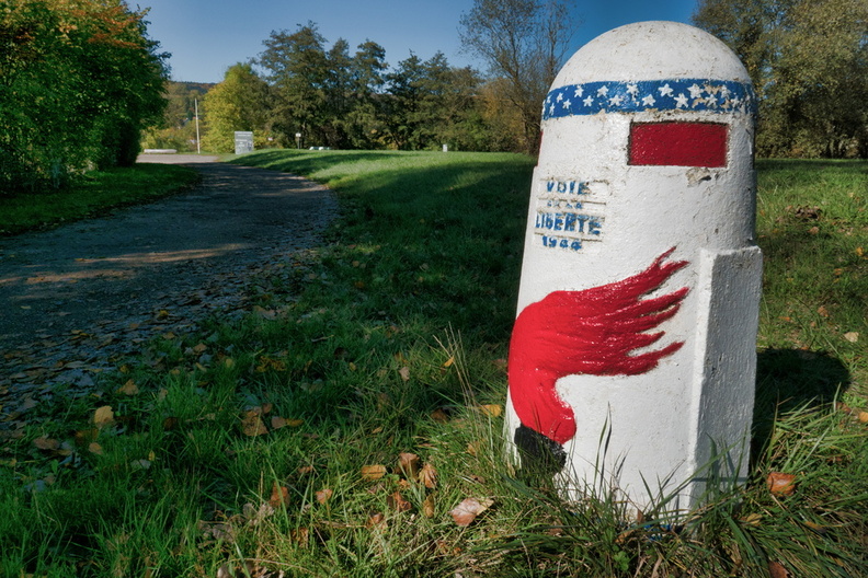
Liberty Road (French La voie de la Liberté) is the commemorative way marking the route of the Allied forces from D-Day in June 1944
- Palette
- Created on
- Saturday 14 October 2017
- Posted on
- Thursday 26 September 2019
- Tags
- common:Parcours historique de la Bataille de Dornot, country:France, country_code:fr, county:Metz, France métropolitaine, Grand-Est, la Moselle-Saône à vélo, memorial:Parcours historique de la bataille de Dornot, Moselle, postcode:57130, road:D 657, state:Grand Est, suburb:Fontaine de Luzéraille, village:Jouy-aux-Arches
- Visits
- 2599
- Location
- View on OpenStreetMap
- Rating score
- no rate
- Rate this photo
- Make
- Panasonic
- Model
- DMC-TZ100
- DateTimeOriginal
- 2017:10:14 13:40:48
- ApertureFNumber
- f/8.0
- iptc_keywords
- France métropolitaine, Grand-Est, Moselle, common:Parcours historique de la Bataille de Dornot, country:France, country_code:fr, county:Metz, la Moselle-Saône à vélo, memorial:Parcours historique de la bataille de Dornot, postcode:57130, road:D 657, state:Grand Est, suburb:Fontaine de Luzéraille, village:Jouy-aux-Arches
- iptc_caption
- Liberty Road (French La voie de la Liberté) is the commemorative way marking the route of the Allied forces from D-Day in June 1944
 Download Photo
0 comments