24/99
Home / Hiking and walking / Luxembourg National Footpaths / Sentier de la Moselle /
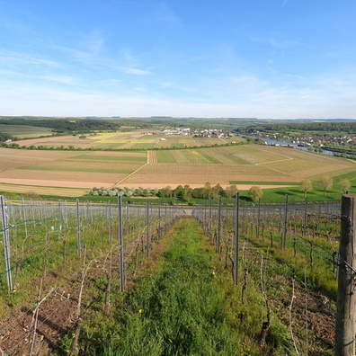
Moselle valley near Greiveldange

 Download Photo
)
)
)
)
)
- Palette
- Created on
- Thursday 4 May 2023
- Posted on
- Friday 2 June 2023
- Tags
- country:Lëtzebuerg, country_code:lu, county:Canton Remich, hiking:European long distance path E2, hiking:European long distance path E3, hiking:GR 5, hiking:Sentier de la Moselle, ISO3166-2-lvl6:LU-RM, man_made:Stadtbredimus, Moselle, postcode:5426, river, road:CR 146, village:Greiveldange, vineyard, water
- Albums
- Visits
- 1019
- Location
- View on OpenStreetMap
- Rating score
- no rate
- Rate this photo
- Make
- samsung
- Model
- SM-S908B
- DateTimeOriginal
- 2023:05:04 17:34:18
- ApertureFNumber
- f/2.4
- iptc_keywords
- ISO3166-2-lvl6:LU-RM, Moselle, country:Lëtzebuerg, country_code:lu, county:Canton Remich, hiking:European long distance path E2, hiking:European long distance path E3, hiking:GR 5, hiking:Sentier de la Moselle, man_made:Stadtbredimus, postcode:5426, river, road:CR 146, village:Greiveldange, vineyard, water
0 comments