Home
Tag
Climb the Hills, Chase the Sauer!
Photo sizes
S - small
(576 x 384)
M - medium
(792 x 528)
L - large
(1008 x 672)
XL - extra large
(1656 x 1104)
XXL - huge
(2048 x 1365)
Original
slideshow
Download this file
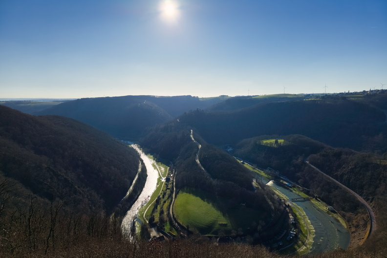
A panoramic view of the Sauer River winding through the verdant hills of Luxembourg.
Information
Rating score
no rate
Rate this photo
Created on
Saturday, February 1, 2025
Posted on
Monday, February 10, 2025
Visits
3014
Albums
Outdoor adventures
/
2025
/
February 2025
Hiking and walking
/
Luxembourg National Footpaths
/
Sentier du Nord
Panorama
Tags
aerial view
backpacking
bridge
bright sun
clear sky
country:Lëtzebuerg
country_code:lu
countryside
county:Canton Diekirch
daytime
ecology
escapardenne lee trail
farmland
forest
hamlet:Buurschter-Millen
hiking
hiking:BS 1
hiking:BS 4
hiking:BS 6
hiking:Escapardenne Lee Trail
hiking:GR 57
hiking:Sentier du Nord
hiking:Vallée de l'Ourthe-Gilsdorf
hills
Natura 2000:Région du Kiischpelt
outlook
panorama
pasture
power lines
protected area
river
river bend
road
Sauer
Sauer river
scenic
shadows
sunlight
sunshine
tourism:Gringlee
trail
trees
valley
viewpoint
viewpoint:Gringlee
village:Lipperscheid
water
waterway
wind farm
wind turbines
winding river
winding road
woodland
Powered by
Piwigo